Hiking Trails of Rich Mountain Wilderness
Relocating to North Georgia mountains? Check this Out! Great Georgia Properties

Georgia Mountain Real Estate
Home | Homes For Sale | Farms For Sale | Lake Property | River Properties | Mountain land | Commercial Real Estate
Hayesville North Carolina | Murphy North Carolina | Hiawassee Ga | Blairsville Ga | Blue Ridge Ga | Young Harris Ga
about Lake Chatuge | about Lake Blue Ridge | about Lake Nottely | Advantage Chatuge Realty
Georgia Outdoor Mountain Adventures | Georgia Mountain Waterfalls | Hiking trails of the Georgia Mountains | Georgia State Parks
Chattahoochee National Forest | Hiking Trails at Vogel State Park | Hiking trails of the Cohutta Wilderness
Home > Georgia Outdoor Mountain Adventure >
Aska trails Blue Ridge Georgia
South of Blue Ridge and east of Ellijay, the Aska area has a 17-mile hiking and mountain biking trail system.Located in the Chattahoochee National Forest, the trails include Deep Gap and Stanley Gap trails that ascend to near 3,200 feet, offering beautiful views of mountain ridges, and then descends to the shores of Lake Blue Ridge.
Aaron Mountain
This mountain has a rounded dome covered with rich, black soil and a wildflower display in spring. An old timber growth believed to be over 129 years old lies on the south face of Aaron Mountain. At Horse Cove, there is a good boulder field and a northern hardwood forest with some possibly record-sized, second-growth trees, especially silverbell.
Lake Blue Ridge trail
6/10th a mile. A loop trail that follows the shoreline of Lake Blue Ridge and offers a beautiful view of the lake.
Flat Creek loop trail
This 5.8-mile, moderately difficult loop trail provides a range of forest as well as a brief time by a mountain creek.
Green Mountain trail
This 3.3-mile trail offers views of Lake Blue Ridge after cresting the mountaintop. A very pleasant hike or bicycle ride, including running alongside the shoreline of Lake Blue Ridge. The forest is made up of a variety of southern Appalachian hardwood. The trail begins on the east side of Aska Road at Deep Gap and starts as a gradual climb toward the summit of Green Mountain. On the trail there are five short, relatively steep ascents, but they are not demanding. The Green Mountain ridge provides a bird's eye view of Charlie's Cove and Lake Blue Ridge. The trail then descends for 2.4 miles to its end on FS 711.
Owltown Creek mountain bike trail
The Owltown Creek Trail is the access point for the Owltown Mountain Trail, and, while only 4 miles long, the loop offers something for riders at every skill level: tight, rocky single track; a few creek crossings; some steep descents and ascents; grassy, double track; and a gravel road. The Ellijay Chapter of SORBA (Southern Off-Road Bicycle Association) and the Cartecay River Bike Shop, the bike shop in the area, hold beginner/intermediate bike clinics on this trail. True beginners might want to start the ride at the lower end of the trail where it crosses the bridge on Owltown Creek.
River Loop mountain bike trail
The River Loop is a 3.4-mile, intermediate/advanced trail just below the Red & White that follows the Cartecay River in sections. The single track is tight in spots, a few rocky descents challenge even the bravest riders to walk, a sand trap swallows your tires near the river, and an occasional windblown tree clutters the trail. Once you conquer the steep downhill, you can cool down with a dip in the Cartecay River or nap in the sun on the rocks. This is a beautiful ride, and it can easily be coupled with a ride on the Red & White or other trails in the area to make a full day of riding.
Stanley Gap Trail
This trail offers a moderately strenuous 5-mile hike (one-way) or a difficult 12-mile bike ride which includes the mileage along the roads to return to the trail head. The forest is unmatched in its diversity throughout the country. Views of surrounding mountains, and winter view of Lake Blue Ridge, add to the outdoor beauty of this trail.
Red & White mountain bike trail
The Red & White and River Loop trails are sister trails located in the Cartecay Tract of the Rich Mountain Wildlife Management Area off Highway 52 East. The Red & White is a 2.6-mile, beginner/intermediate trail closest to the entrance of the management area. This trail is a single-track loop with occasional rocky or rooty sections. Dogwoods line this trail and brighten the trail in the spring. Be prepared for a long climb near the end of the trail. If you're looking for a short, relative easy ride, be careful not to turn on the River Loop or you might be out longer than you planned.
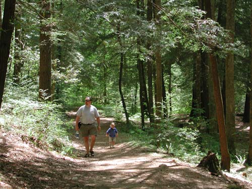
Hiking trails of Rich Mountain Wilderness
Located between Blue Ridge and Cherry Log the Rich Mountain Wilderness area offers a number of well marked hiking & biking trails where you will find creeks & waterfalls. The old growth forest is home to a variety of wildlife indigenous to this area. The 13,276-acre Rich Mountains are primarily wilderness (9,649 acres) and primitive backcountry (3,627 acres) that is not heavily used.
It generally follows Murphy's stratified rock which divides the the Blue Ridge from the Cohuttas. The unaware visitor driving up US 76 in between this rock formation would miss the Rich Mountain area because the higher peaks and ridges are barely visible from the road.
Only experienced hikers should explore the Rich Mountains area and carry a compass, topographical maps, and other survival gear. Beware of the large bear population . Always let someone know your hiking plans and expected time of return.
Directions: To Rich Mountain area
From Blue Ridge go South on Aska Rd. 8 miles and go right on Stanley Creek Rd. follow to end of pavement. The Forest Service land starts .1 miles after the pavement ends where you will find the 1st of many trails this one goes off to the right and leads to a picturesque waterfall.
Activities: hiking, biking
Facilities: Varies on loaction
Fees: Varies on Loacation
Closest town: Blue Ridge Georgia
For more information:
Blue Ridge Mountain Real Estate
Home | Homes For Sale | Farms For Sale | Lake Property | River Properties | Mountain land | Commercial Real Estate
Hayesville North Carolina | Murphy North Carolina | Hiawassee Ga | Blairsville Ga | Blue Ridge Ga | Young Harris Ga
about Lake Chatuge | about Lake Blue Ridge | about Lake Nottely | Advantage Chatuge Realty
Georgia Outdoor Mountain Adventures | Georgia Mountain Waterfalls | Hiking trails of the Georgia Mountains | Georgia State Parks